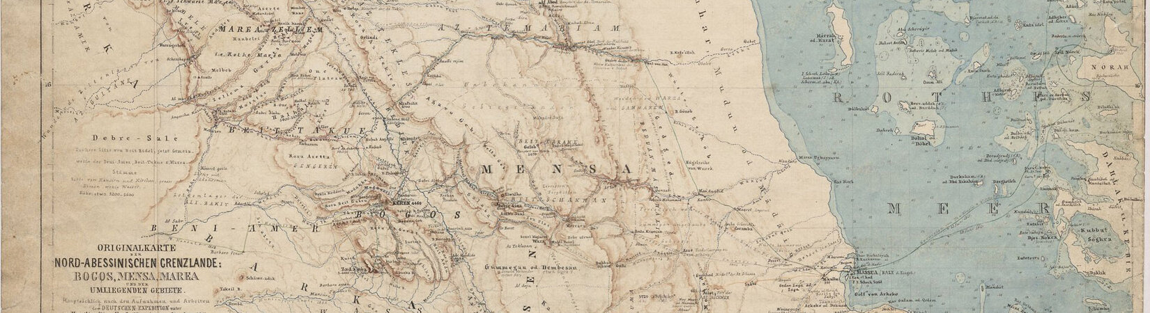
Bruno Hassenstein, Originalkarte der nord-abessinischen Grenzlande,Maßstab: 1 : 500.000, 1864 © Perthes Collection / Gotha Research Library, SPK 547-112085962
Cartographies of Africa and Asia (1800-1945)
A digitization project for the Perthes Collection in Gotha
The Perthes Collection, legacy of the publishing houses Justus Perthes in Gotha, Justus Perthes in Darmstadt and VEB Hermann Haack in Gotha, is one of the most important map publishing archives in continental Europe. Among other things, it consists of map collection encompassing almost 200,000 sheets. It includes both the maps produced in Gotha in all stages of production as well as the international map production acquired by the publishing house since the beginning of the 19th century. Thanks to the support of the German Federal Ministry of Education and Research, a first central part of the map collection is now being catalogued and made accessible worldwide. Within two years, more than 35,000 maps of Africa and Asia from the years 1800-1945 will be catalogued, digitized, and made available to the (specialist) public. All digitised material will be published via the Digital Historical Library of Erfurt/Gotha (DHB), hosted by the Thuringian University and State Library in Jena.
Project activities and results
Regular digital meetings of the working group “Territoriality and Cartographic Knowledge”.
In the media - MDR report on the project
Conferences
- Workshop "Epistemologies of Digitalisation: Digital Repositories and their Consequences for Science and Research", 18 January 2022, digital
- International Conference “Mapping Asia”, 24-25 November 2022, Research Centre „Transcultural Studies / Gotha Perthes
Associated with the project
- Gotha Research Library
- Research Institute for Transcultural Studies
- Digital Historical Library of Erfurt/Gotha (DHB)
- The Transimperial History Network
Objects related to the project
- Digitised items from the Perthes Collection at the DHB, section Africa and Asia maps.
Project Information
Organization
Gotha Research Library
Transcultural Studies / Gotha Perthes Collection
Project Management
Prof. Dr. Iris Schröder (Research Centre „Transcultural Studies / Gotha Perthes"),
Dr. Petra Weigel (Gotha Research Library)
Project Participants
Dr. des. Claudia Berger
Yvonne Gräser
Karl Franz Hutter
M.A. Andreas Pügner
Martina Schröder
Julia Toni
Duration
5/2021–1/2023
Funding
Federal Ministry of Education and Research
Citation link
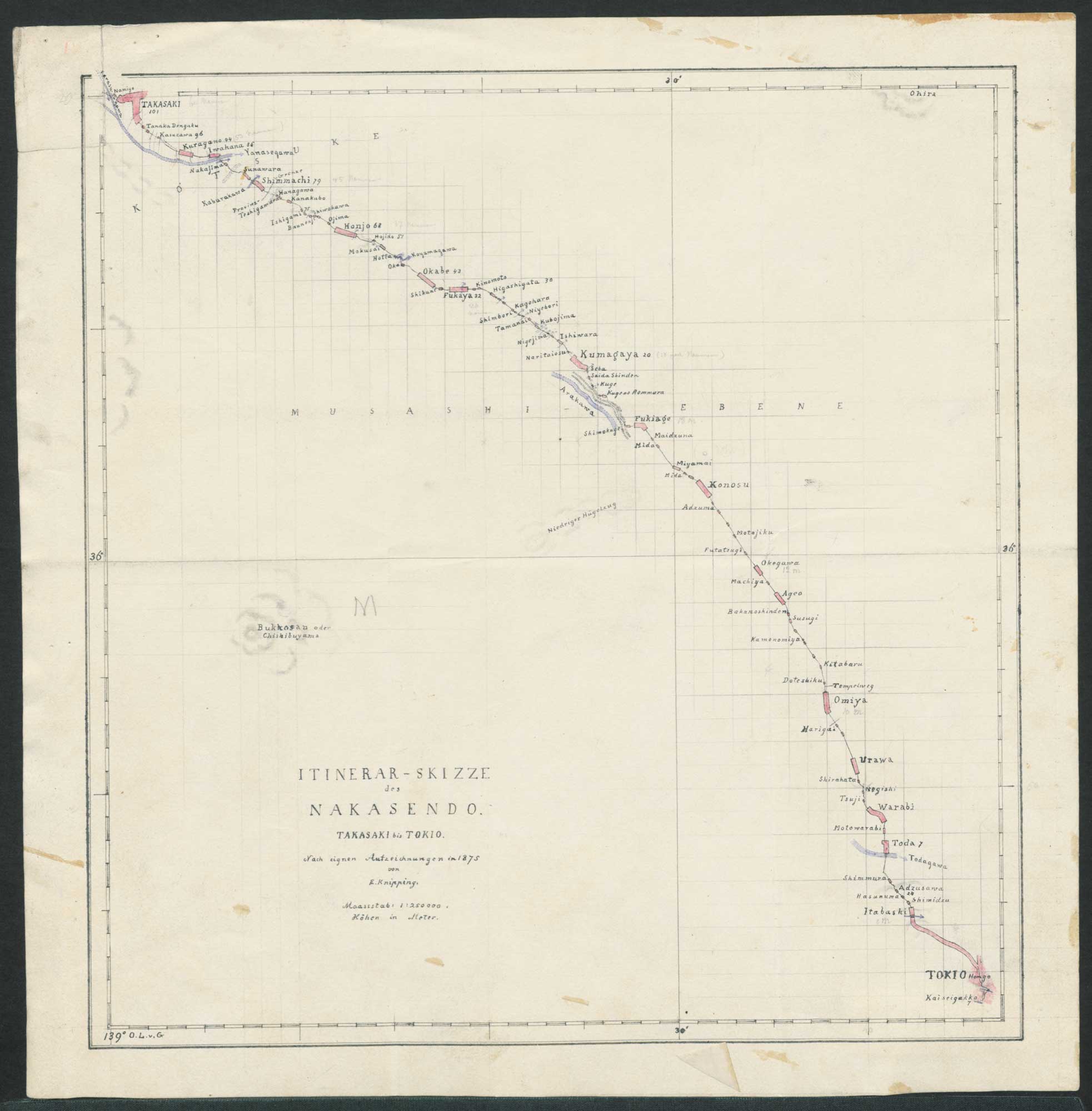
Example of a map of Asia
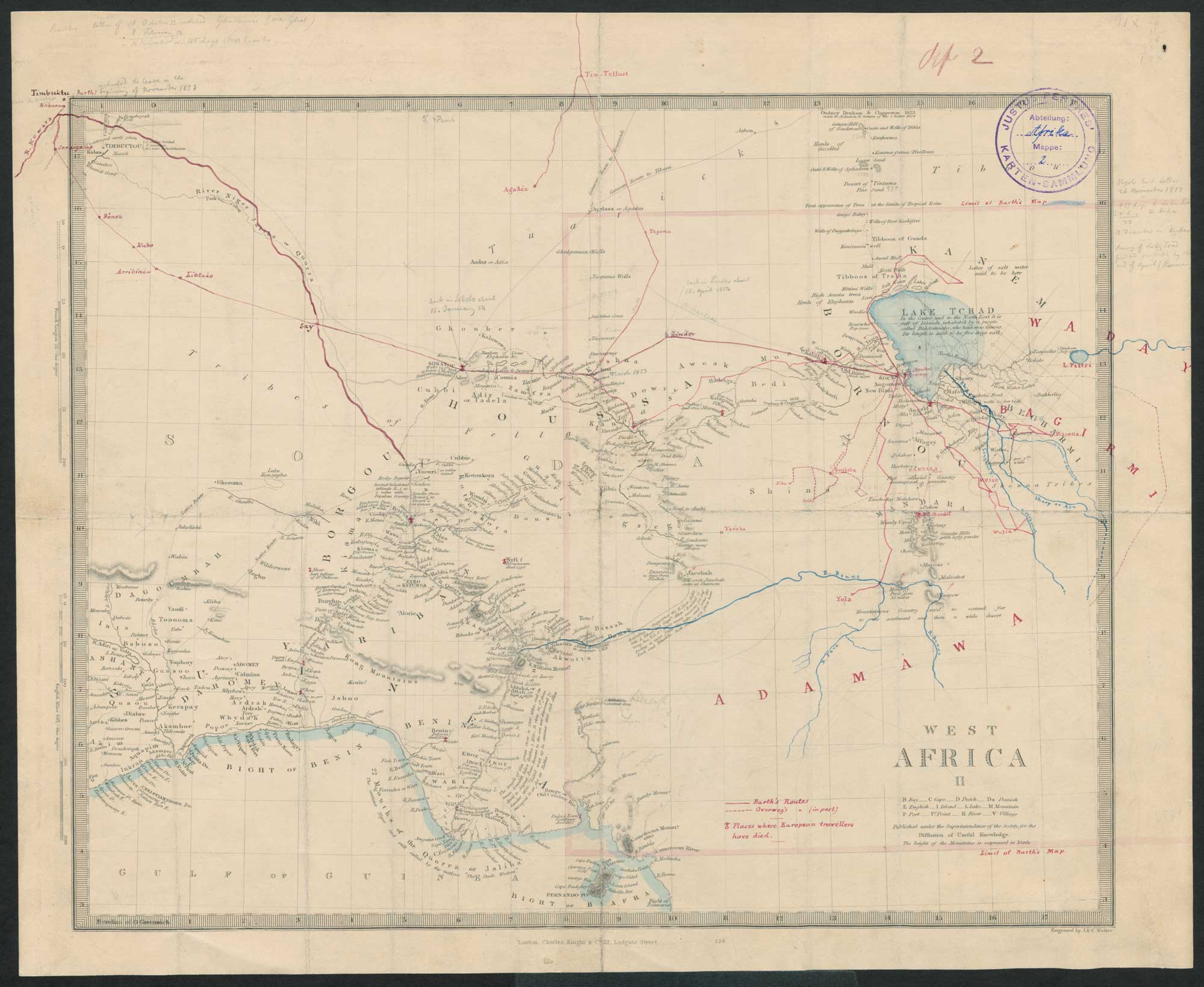
Example of a map of Africa